Precise Surface and Underground Surveying Services
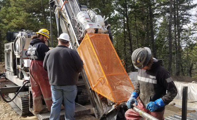
RMS utilizes the most advanced surveying equipment and techniques available to deliver highly accurate survey scans, both on the surface and underground. Our systems are noninvasive, so the surrounding area is undisturbed, and we will determine the best technologies to use for the specific environment.
Ranging from GPS and an assortment of highly specialized drone scanners, our equipment can determine critical information such as the position and depth of utilities, structures, voids, anomalies, and potential hazards. The data we capture allows you to make informed decisions about your project and its feasibility, and it is ideal for permitting, production, and reclamation.
We use the following equipment to deliver the most accurate surveying possible.
- GPS (Leica GPS1200 GNSS)
- DJI Matrice 300 RTK & DJI Mavic Pro Drones
- Aerial Photogrammetry
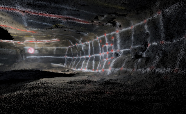
- Aerial LIDAR Scanning using Matrice 300 and Hovermap Scanner
- Underground Surveying using Leica Total Station
- Underground Scanning using Hovermap Scanner
- Underground inspection and video using drones & remote camera/scanner systems.
- Underground scanning using Drone and Hovermap Scanner